
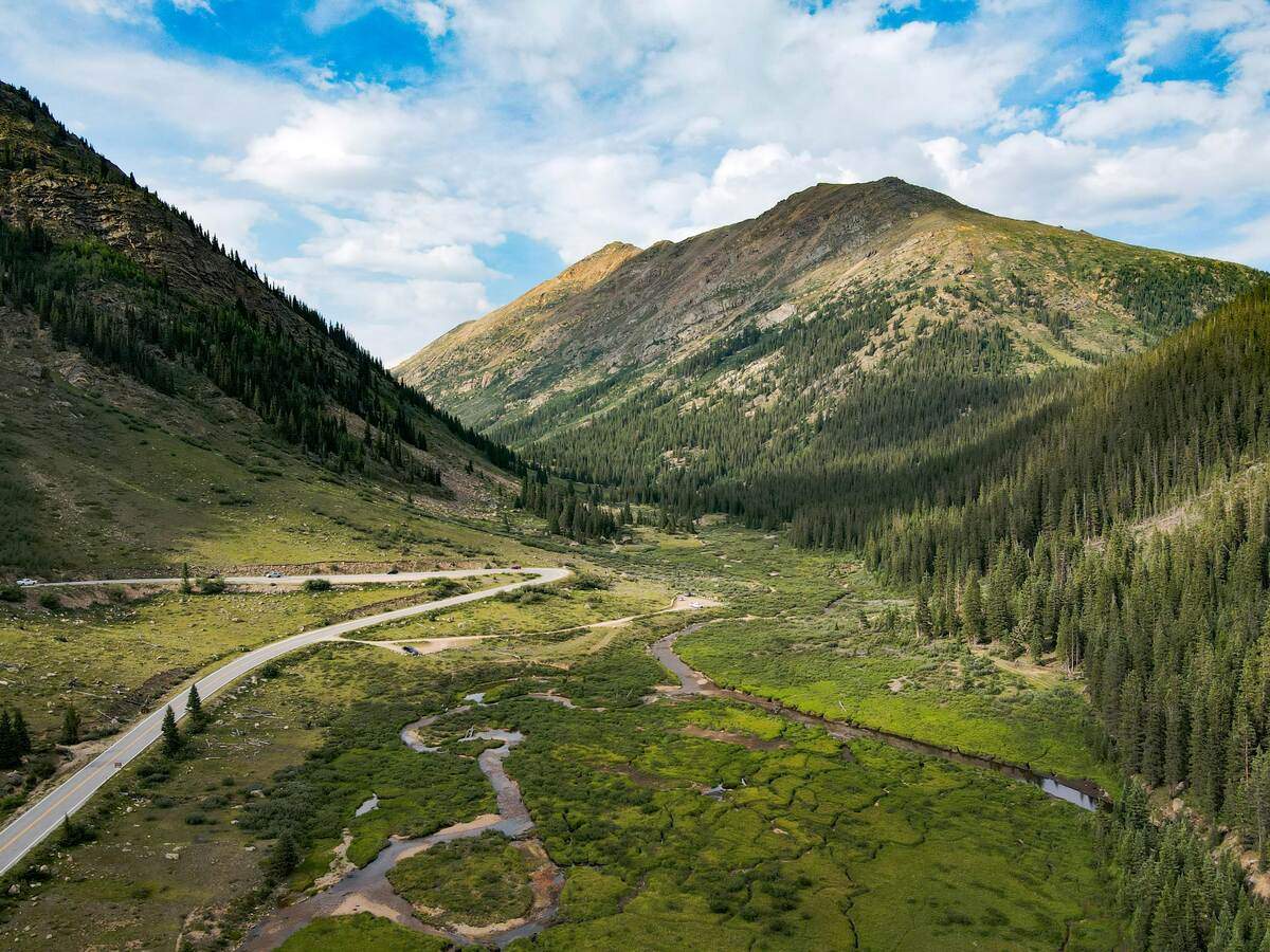
For those craving serious elevation gain, rugged terrain, and the thrill of altitude, the Denver area delivers. These challenging hikes demand strong legs, solid navigation skills, and respect for mountain weather. From 14,000-foot summits to steep, heart-pounding inclines, here are the best routes to push your limits and reward yourself with unforgettable panoramas. If you’re looking for something more approachable, check out our guide to the top hiking trails near Denver for day-hikers.
What Makes a Hike “Challenging” in Colorado?
Colorado’s high-country terrain means difficulty isn’t just about distance. Factors include:
- Elevation gain & altitude: Climbing 2,000–3,600 feet in a few miles at 10,000+ feet tests cardiovascular limits.
- Technical sections: Expect rock scrambling, narrow ridgelines, and uneven footing above treeline.
- Weather unpredictability: Thunderstorms can roll in suddenly; snow and ice linger on shaded slopes even in summer.
- Remoteness: Long approaches and limited cell service demand thorough planning and emergency preparedness.
Before you tackle these routes, build a solid base with moderate hikes and follow proper acclimatization guidelines.
Must-Do Hardcore Routes
Mount Bierstadt via Guanella Pass

Distance: ~7 miles round-trip
Elevation Gain: ~2,850 ft
Drive Time: 90 minutes via I-70 and Guanella Pass
As one of the most accessible 14ers from Denver, Bierstadt is both popular and punishing. Starting at 11,600 feet, you climb relentlessly above treeline, with steps cut into talus slopes leading to the summit at 14,065 feet. The view spans the Front Range below and endless snow-capped peaks beyond. Because storms often hit in the afternoon, the standard advice is to begin before dawn and be off by midday.
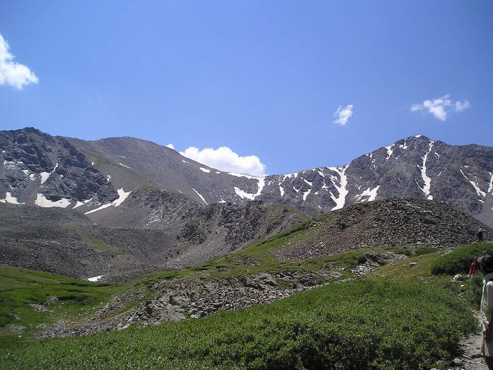
Grays and Torreys Peaks (Double 14er)
Distance: ~8.5 miles loop
Elevation Gain: ~3,600 ft
Drive Time: 90 minutes via I-70 to Loveland Pass
If one 14er isn’t enough, bag two in a day on this classic circuit. Grays Peak is a relatively straightforward ascent, but the traverse to Torreys involves ridge scrambling and careful footing. The payoff is conquering two summits over 14,000 feet and witnessing a spectacular Rocky Mountain panorama that few trails can match.
Sky Pond via Glacier Gorge (Rocky Mountain National Park)
Distance: ~9 miles round-trip
Elevation Gain: ~1,700 ft
Drive Time: 90 minutes to RMNP’s Bear Lake Corridor
This route is part day hike, part mountaineering scramble. From Glacier Gorge Trailhead, you pass The Loch and Timberline Falls before the final push over slippery rock slabs to Sky Pond’s emerald waters. The journey features cascading waterfalls, glacial cirques, and even some boulder hopping—definitely bring sturdy boots and patience.
Chicago Lakes Trail
Distance: ~9.5 miles round-trip
Elevation Gain: ~2,600 ft
Drive Time: 75 minutes via I-70 to Idaho Springs
Steep switchbacks guide you through aspen forests before opening onto the alpine basin that cradles Chicago Lakes. Framed by granite cliffs, the twin lakes sit at 12,000 feet—perfect for an early morning visit when glassy reflections mirror the surrounding peaks. Watch out for snowfields lingering into summer and always check trail conditions.
The Manitou Incline (Colorado Springs)
Distance: ~1 mile straight up
Elevation Gain: ~2,000 ft
Drive Time: 2 hours south on I-25
Though technically outside Denver, the Incline deserves mention for sheer intensity. Over 2,700 railroad ties form a staircase straight up the mountainside, gaining 2,000 feet in under a mile. It’s a love-hate relationship: local legend says “you either love the burn or hate it forever.” Either way, it’s a must-try for serious thrill-seekers.
Preparation & Safety
- Acclimatize: Spend at least one full day at altitude before attempting these treks, especially if you’ve flown in from sea level.
- Weather watch: Check forecasts at NOAA or park websites, and carry rain gear—even in summer.
- Pack wisely: Carry 3–4 liters of water, high-calorie snacks, a headlamp, and extra layers.
- Navigation: Offline GPS and a paper map are both crucial; many summits have no cell signal.
- Group up: Tackling a 14er alone is not recommended—go with a partner or group and share your itinerary with someone at home.
Build Your Skills
Mastering moderate hikes is a smart stepping stone before pursuing these challenges. If you haven’t already, try the rewarding 6-mile loop at Mount Falcon or the waterfall-framed route to Ouzel Falls to hone your endurance and gear choices—or explore our top hiking trails near Denver for day-hikers.
For a guided introduction to harder hikes with panoramic payoffs, explore our list of the best moderate hikes near Denver for adventure seekers.
Frequently Asked Questions
- What qualifies as a “14er”?
- A mountain with a summit elevation over 14,000 feet. Colorado has 58 official fourteeners.
- Do I need a permit?
- National parks like RMNP require timed-entry tickets during peak season. State parks have daily or annual pass requirements.
- When’s the safest season?
- Mid-July through early September offers the most stable conditions. Snow and ice can linger on upper slopes well into July.
- Are these trails dog-friendly?
- No—most high-alpine and desperate scrambles aren’t suitable for pets. For canine-friendly options, see our recommendations for dog-friendly hikes near Denver.
After the Ascent
Celebrate wisely: stretch, refuel with a hearty meal in nearby mountain towns, and swap summit stories with fellow hikers. You’ve earned it. When you’re ready for new challenges, consider exploring high-elevation waterfall routes or hidden trail networks that few visitors ever see.
Conquering these challenging hikes near Denver not only tests your physical and mental limits but also rewards you with some of the most breathtaking panoramas on the Front Range. Lace up, hydrate, and respect the mountains—adventure awaits.


Leave a Reply